- depth to which overlying surface wave is causing water molecules to move.
- roughly 1/2 the wavelength.
- for water depths < wave base the waves can move sediment around.

Lecture index:
What shapes coastlines?
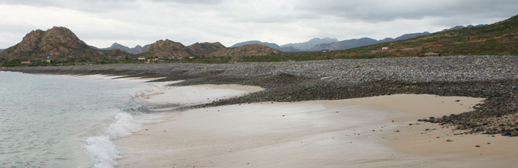
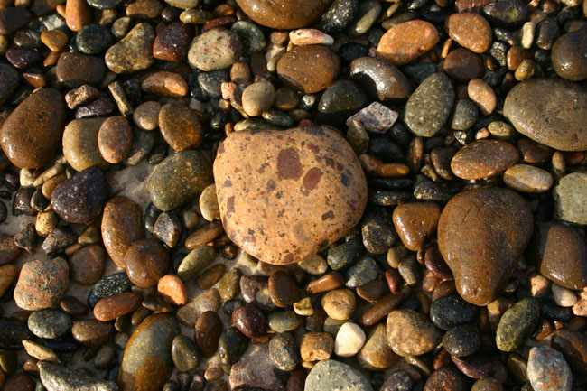
Coastlines are the interface between the terrestrial and the marine and as such very dynamic locations.
What are the processes that move sediment, shape coastal landforms, and determine the geologic evolution of coastlines?
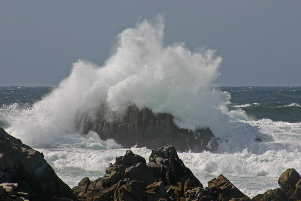
waves:
storms:
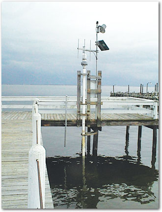
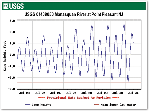
tides.
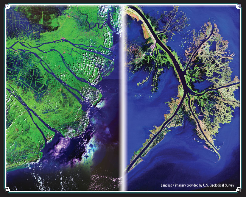
river sedimentation ('deltaic' forces): supplier of sediment.
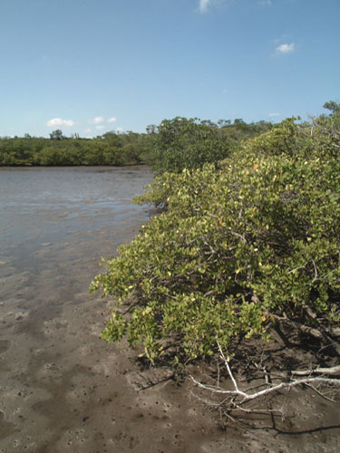
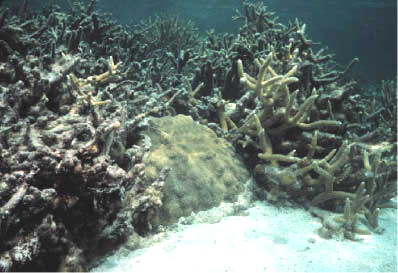
biologic processes(esp. reefs, mangrove swamps).
Other factors/processes:
The result of this complex interplay is a great diversity of coastlines. We will look at just three types:
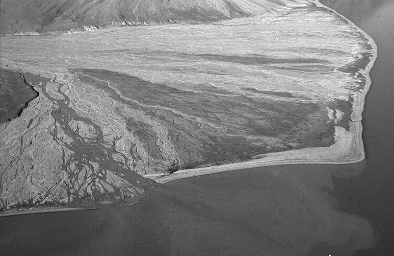
Image of a delta building out into a fjord
in Svalbard. Since this fjord was occupied by ice some 15,000
years ago or less, we know this delta has built out in that time
period. Note the active portion to the left where transport and
deposition is occurring via a braided stream. The oldest portion
of the delta surface is the darker surface, where tundra vegetation
has had a chance to establish itself. The braided stream has
wandered back and forth over the delta surface with time. Note
also the thin narrow beach ridge that has trapped small ponds
behind it. What process is it that forms the smooth beach ridge,
and why doesn't the delta have a birds-foot shape? Remember that
this is in a more sheltered fjord.
Definition of a delta: body of sediment that forms and builds out where a river meets a lake or the sea.
How can deltas be classified?
Subsidence and mass wasting as contributing processes.
Evolution of in map view, lobe switching and abandonment.
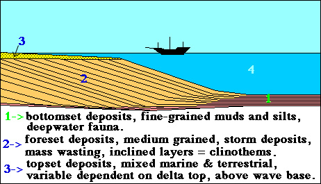
This diagram is a repeat of material already presented (the portion on shifting depositional environments), and captures how with progradation the geologic record a delta is expected to produce is a grain size coarsening upward sequence.
Barrier islands are relatively long and sandy islands parallel to the coast, with lagoons or bays behind them. They are common with low profile sandy slopes, e.g. associated with coastal plains. The island is fundamentally caused by wave action piling up sediment and vegetation working to stabilize it.
Better known examples of barrier islands include: Padre Island, Galveston, Hilton Head - common along the Gulf Coast and southern half of east coast of the U.S..
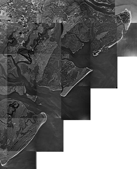
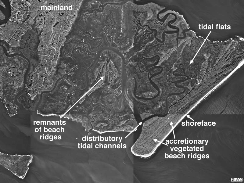
Air photo mosaic images of barrier island complexes SE of Savannah Georgia taken from USGS ( now defunct terraserver site). In this particular case the barrier islands appear attached to the mainland by tidal flat areas, but are separated from the mainland by tidal channels.
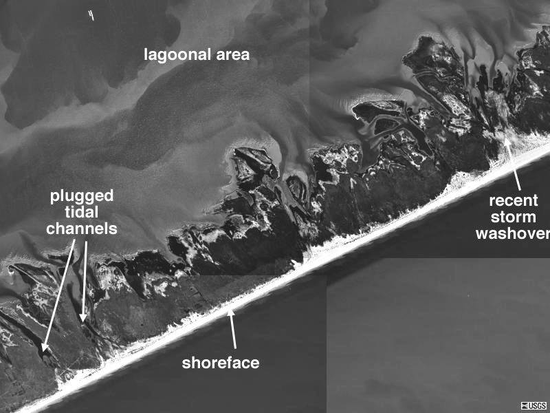
This is a photo mosaic form USGS (terraserver site) of Gulf coast barrier island SW of Houston with some of the major island components labeled.
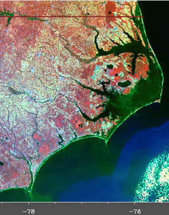
This is a false color satellite image of thin barrier island complexes along North Carolina coast that includes Kitty Hawk.
Geomorphic components of the system include: offshore sand bars, shore face, dunes, spillover fans, tidal channels, lagoonal area. You will work with these more in an upcoming lab
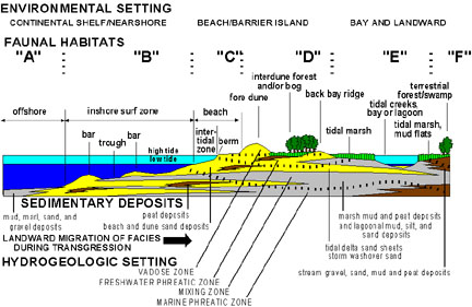
Diagram from USGS site http://3dparks.wr.usgs.gov/nyc/shoreline/beaches.htm that shows many of the components of a barrier island, with older, now submerged deposits when sea level was at a lower level.
Character of sediments in different portions of the complex?
Dynamics of change?
storms:
- storms transport sediment back into the lagoonal area via spillover fans.
- storms transport debris semi-permanently offshore (representing a loss to the sand budget).
- brings up question of what is more important to the shape and character of the Barrier Island - day to day events and dynamics (e.g. tidal events) or rare events such as the 100 year hurricane. One could compare, for example, the volume of sediment moved by each during the time span under consideration.
What will cause barrier island dynamics to change and migrations of the islands to occur?

Simplified navigation map of Tybee Island area near Savannah, Georgia
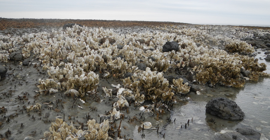
This is a dead oyster bed on the ocean shore face of Little Tybee Island which tells a story. Oysters like to grow in the protected tidal areas in back of the barrier islands, and not out in the shore face or open ocean environment. The oysters are bleached and no longer living, and one can also see the remnants of tidal marsh grass and organic rich sediments they once grew on here. There used to part of Tybee island in between this location and the ocean, but it has since retreated toward the land, over this once protected, tidal marsh area, leaving it exposed to ocean waves and erosion.
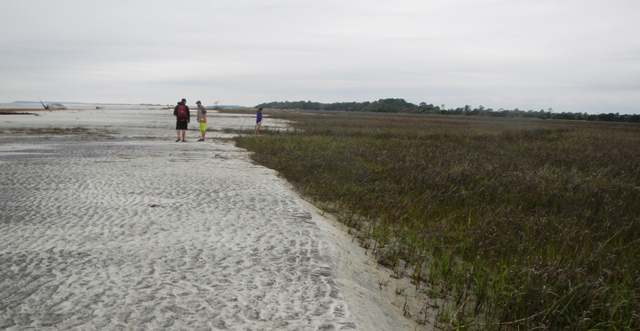
This is also on Tybee island and shows the beach sands advancing inland over the tidal marsh grasses. These photos were taken on a UNO geology field trip.
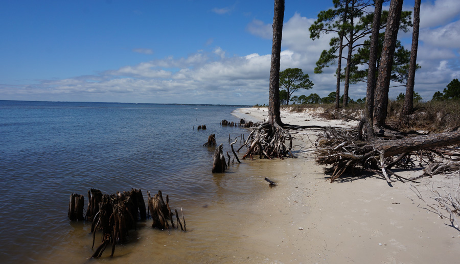
This is the shore face part of a barrier island on the Gulf side of Florida (near Balk Point State Park. Clearly the shore face is undergoing substantial erosion and retreat here.
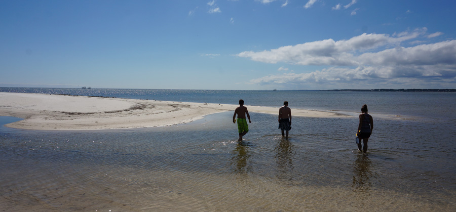
Same barrier island as above, and view of a small curved sand spit on the end of the larger spit, with UNO students for scale. Barrier Islands can grow in length as new sand accumulates at spits end.
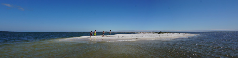
Spits end for now.
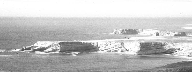
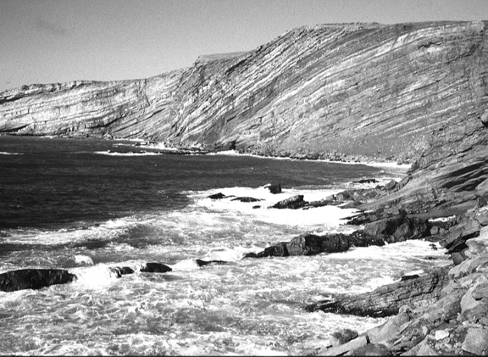
Some features associated with emergent coastlines - sea cliffs, wave cut terraces, sea stacks, sea caves, sea arches. Differential erosion plays an important role in the production of the later three.
Importance of wave cut terrace formation: undercutting, mass wasting, and with time sea cliff retreat.
Examples: sections of California's coast line due to tectonics, and large parts of the Arctic due to rebound from glacial retreat and unloading.

Example from Festningen, Spitsbergen. This is a part of an Arctic archipelago that is undergoing isostatic uplift because of deglaciation. One can see the present shoreline with the retreating cliff line, and then a topographic bench in the image center - this is the old wave cut terrace where waves used to do their work, and the now weathered and subdued steeper slope to the right is an older and degraded sea cliff that marked an older and now uplifted shoreline.
Why are discrete 'steps' seen? One explanation can be a spurt of relatively sudden uplift. However, tectonic forces tend to be more steady. Another possibility is the interplay between sea level rise and tectonics. When sea level rise approximately matches tectonic uplift then the waves will cut at the same level for a longer time, and can form a notch, i.e. a wave cut platform.
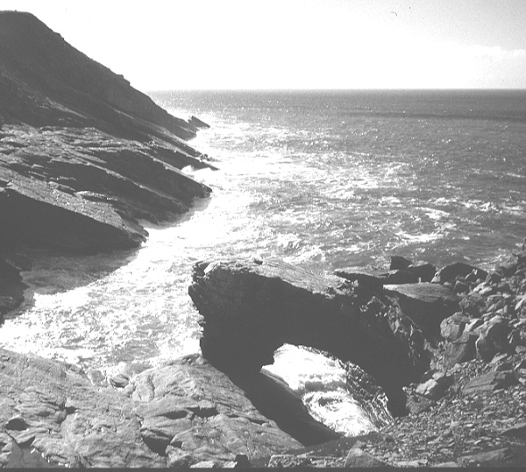
In this photo from Bear Island a sea arch has formed
as the waves have cut through a rock fin of dipping strata with
softer shales beneath harder sandstones. This is one of a number
of erosional features such as sea stacks and sea caves, that form
along erosional and emergent coastlines. The rebound of the crust
after the glaciers melted away makes many coastlines in the Arctic
area emergent.
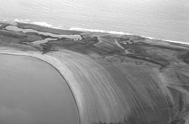
This is a photo from a mountain top looking down on curved beach
ridges in Svalbard. There are literally scores of beach ridges
here, marking the gradual rise of the land out of the sea. Each
beach ridge is made up of coarse gravel, and it is possible to
fine driftwood and whalebones in some of them. The uplift is due
to glacial rebound and associated unloading. An active surf zone
can be seen on the far shore and the process continues, although
probably at a decreasing rate.
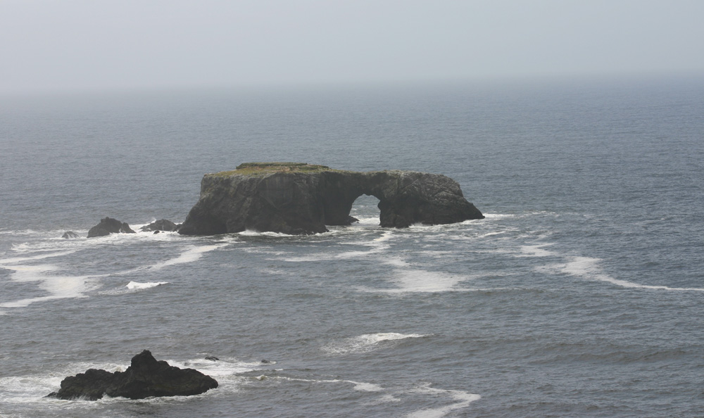
This is a view offshore from Goat Rock along the northern California coast. A flat topped sea stack has a well developed sea arch that the waves have carved into it. Also, note the zone of surf - here the waves are in the process of carving a wave cut platform, which when elevated by tectonics can form a wave cut terrace. The flat top of the sea stack may be the remnants of such a terrace. Click on the image for a larger version.
Harmon D. Maher Jr. reserves copyrights to the materials in this site. Material may be used for non-profit educational purposes as long as proper attribution is given. For permission for any other use please contact author. Thank you.
