Lecture index:
Introduction
What is a glacier? A pile of moving ice that formed from past accumulated snow falls.
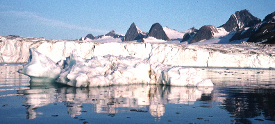
Image of an iceberg in the foreground that calved off of the ice wall front of the glacier in the background. The ice wall is about 60-80 feet high. The whiter parts of the ice wall are where recent calving has occurred, whereas to the left you can see an older, dirtier and weathered part of the ice wall that has been relatiely more stable. In the background is an alpine ridge with small cirques and alpine glaciers feeding this larger glacier. The fjord waters in the foreground and iceberg remind one of how glaciers are a crucial part of earth's hydrologic cycle. This photo is from the inner part of Hornsund fjord in Spitsbergen, Svalbard a suite of Norwegian islands at the juncture of the Atlantic and Arctic oceans.
Alpine vs. continental glaciers (ice caps)?
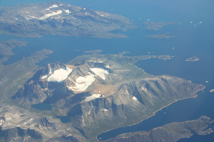
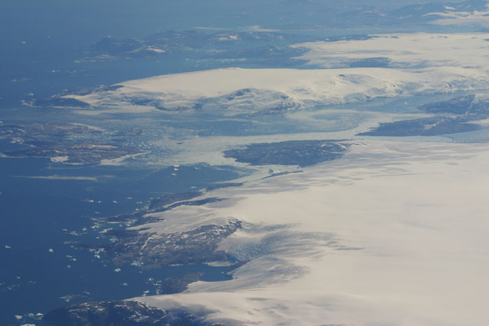
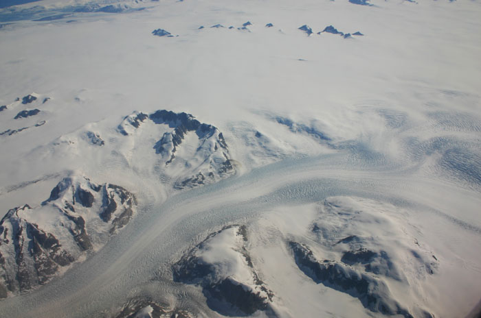
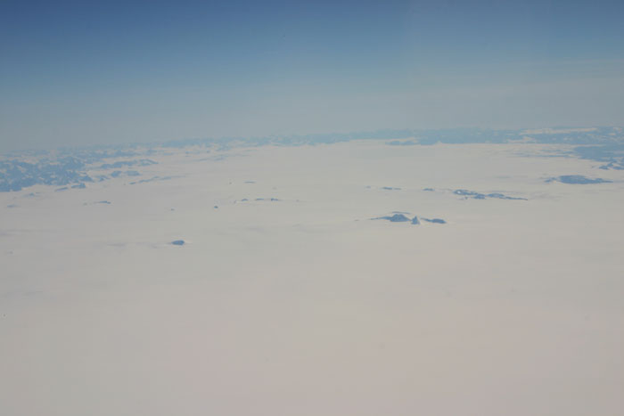
These are all photographs from the 36,000 foot level over Greenland's ice cap (click for larger versions), the second largest glacial body on earth. The small patches of white in the leftmost photo are small alpine glaciers, sitting in rock bowls (cirques) they have excavated as the glacial ice move down the mountain side. These glaicers used to be much larger, and mantled and carved this landscape that is is typical of alpine glaciation. Left center shows the eastern margin of the Greenland ice sheet, with the white expanse to the right being the edge of the Greenland ice cap. The white dots in the Atlantic ocean are icebergs that have calved off. As the Greenland ice cap has shrunk it has exposed more rock, and left behind the isolated alpine glaciers on its margins. Right Center shows a highly crevassed outlet glacier, a high velocity (for a glacier that is) ice stream feeding into the ocean. These ice streams play a very important role in ice cap dynamics. The photo to the right is the expanse of the Greenland ice cap interior looking south towards the tip of Greenland.
What are the conditions necessary for a glacier to form? On average snow fall must be greater than snow melt for a prolonged period of time.
Time lapse photography of glaciers moving:
Transformation process: snow -> granular snow -> firn -> glacial ice. The process takes 12-200 years to complete and involves: a) melting and refreezing, b) compaction and recrystallization.
What are ice movement mechanisms?
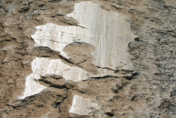
Ablation: loss of ice volume from glacier by melting, sublimation, calving. Sensitive to climatic parameters.
Advances and retreats of the ice front:
Surges:
Surface and sub-ice drainage is vigorous and evident by the number of streams/rivers that exit the front of the glacier and by the sink holes (moulins) on the surface of the glacier. Link to short video on moulins - https://www.youtube.com/watch?v=R7qFeMiL81Y .
Crevasses: deformation in the upper brittle crust: extensional cracks. Location and patterns a function of underlying bedrock geometry and the flow pattern in the ice.
Isostatic depression and rebound: When a icecap grows it depresses the crust slowly due to its weight. This is because the crust if floating in a sense. When ablation dominates and the icecaps is melted, then the crust rebounds, but over a time frame of thousands of years. It is similar to unloading and loading a boat, but where the boat floats in very viscous fluid so that it takes time for the response. Since we have seen deglaciation in the last 10,000 years isostatic rebound is much more common at this point in geologic time.
outwash sediments: glaciers are very efficient erosion and transport agents, and so the meltwaters often have a lot of debris to work with.

Schematic cross section of small alpine glacier.
Components/features of glacial systems
Glacial components: ice, firn, snow, water, rocks, air. How are the rocks incorporated into the glacier?
Erosional land forms: cirques, aretes, horns, U-shaped valleys, fjords, hanging valleys, striations.
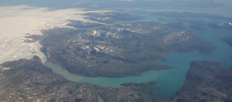 Greenland fjord with retreating ice cap to the left. Note the sediment plume in the upper reaches of the fjord.
Depositional land forms and deposits:
 View of esker in Svalbard exposed by the melting and stagnant glacier front retreat.
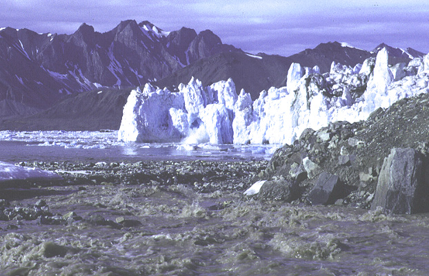
In this photo
can be seen quite a few components of an alpine glacial system.
In the foreground is a glacial outwash stream bringing sediment
down to the fjord. To the right it is cutting into the toe of
some blocky moraine material (till). The calving glacial front
is from a glacier that surged several years prior to this picture.
On top you can see some of the dirty rock debris it carries. Much
of this sediment load is deposited into the fjord waters. A close
look shows a small piece in the process of calving off. Small
ice bergs from prior calving floats in the fjord water out front.
In the background is an alpine ridge carved by past glacial action.
This image is from the St.Jons fjord in Spitsbergen.
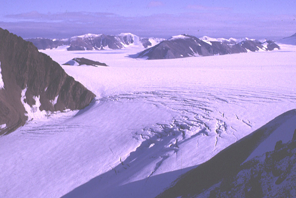
This is a view from Wedel Jarlsberg Land in Spitsbergen
of a icefalls cutting through the rock from a higher glacial plateau.
Because of the bending of the ice slab as it goes over the underlying
rock ledge, and becuase of an increase in velocity, crevasses
open up at the top, and close at the bottom of the ice falls.
These crevasses shown are big enough to drop a car into. Note
also the fresh snow covering the ice. This means that some of
the crevasses are undoubtedly hidden beneath snow bridges. When
traveling on glaciers this is one of the major hazards one must
look for.
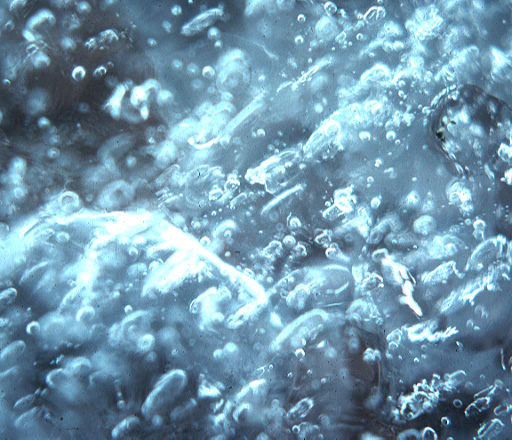
This is a picture of glacial ice showing trapped air bubbles inside. It is these types of bubbles that record past climate information. Note that there are two populations of bubbles. One of these is marked by elongate shapes and are larger. These have the shape they do from shear or creep within the ice that deforms the bubbles. The origin of the smaller, round bubbles is enigmatic to me, but mightbe do to latter recrystallization processes.
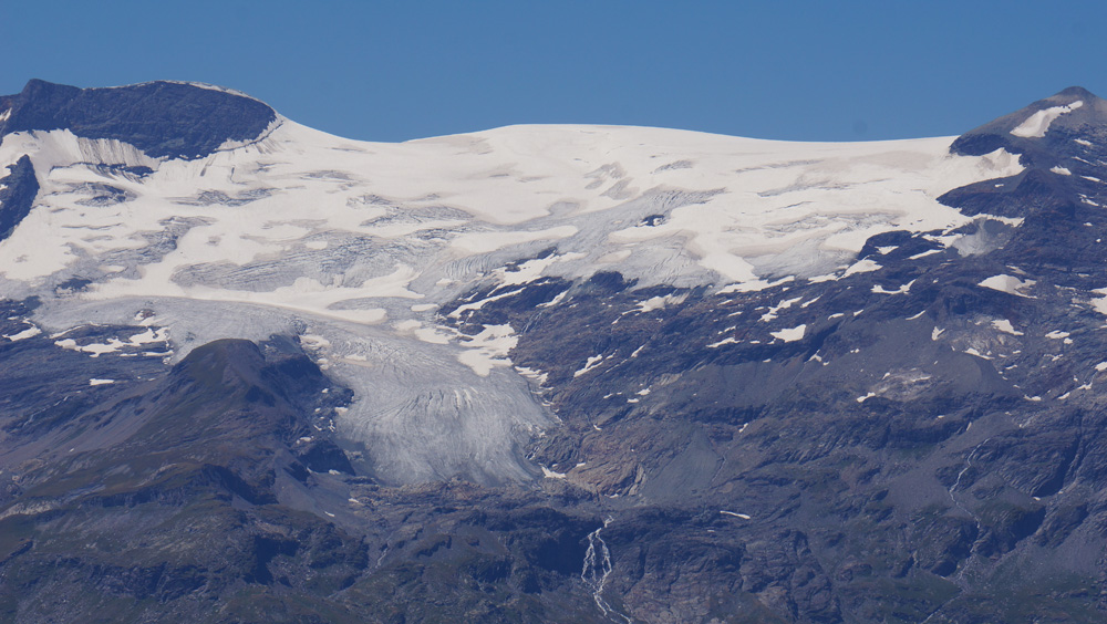
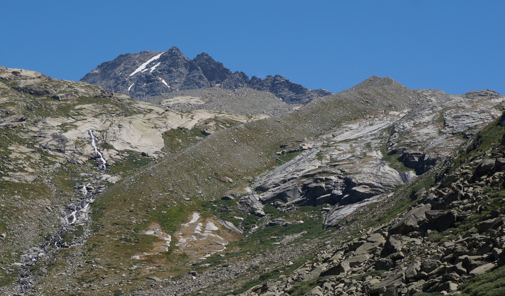
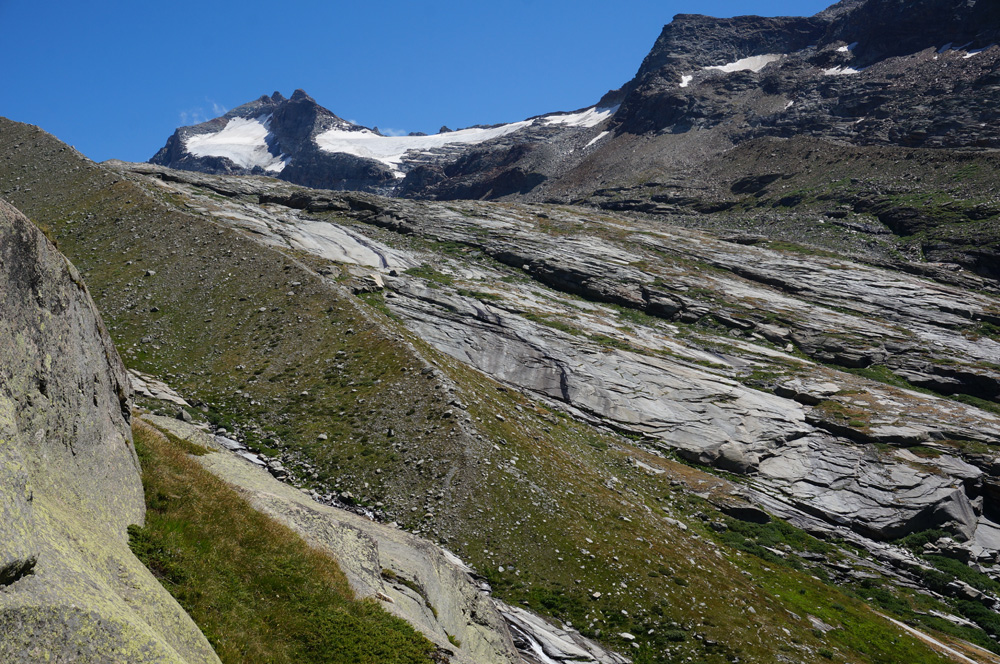
This is a picture of an alpine glacier in the French Alps west of the town of Termignon. In the larger version you can see: a) the fresh snow covering the exposed older ice and the firn line between them, b) the tongue of glacial ice that has move further down slope, c) the crevasses including the larger one towards the top of the glacier called the bergshrund, and d) the differently colored rock in the lower parts that was recently exposed by glacier retreat and hasn't had time to be weathered and have lichen grow on it.
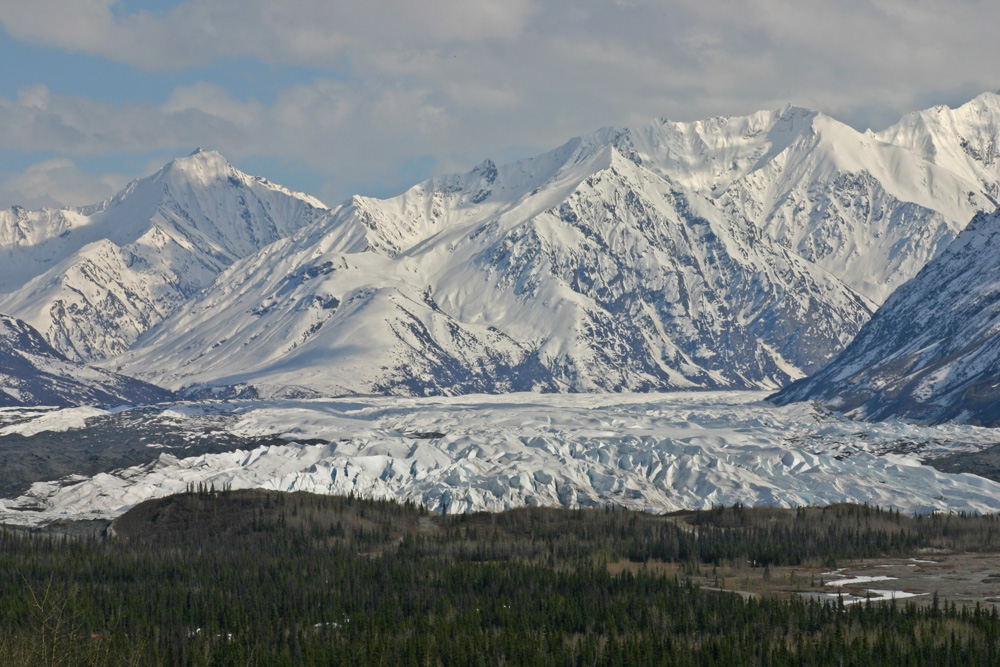
UNO students on Alaska field trip on the snout of the Matanuska glacier. Note the dark morainal material on the sides, and the rock debris that has melted out and is mantling part of the glacier.
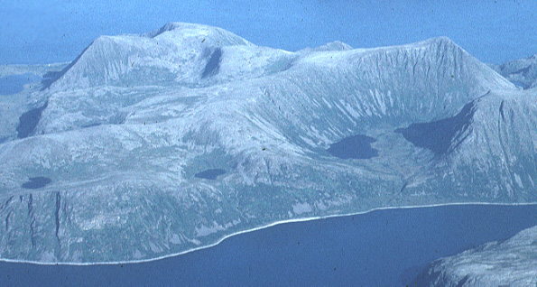
This is a view of part of nothern Norway from the plane.
The glacial ice is gone, but the landscape here is very much a
product of glacial processes. To the right center can be seen
a cirque with two glacial lakes in it (tarns). The depressions
for these lakes were scooped out by the eroding ice. This cirque
is hanging above the fjord, which was also once occupied by ice.
Other small cirques and tarns are also evident. Note that the
top of the mountain is flat. This is likely an erosional surface
formed by an older ice cap that existed. When the ice cap disappeared
Alpine glaciers developed in the next phase of glaciation and
cut down into this older surface. Hence the topography is a bit
different than with Alpine glaciers cut into mountains forming
aretes and horns.
Pleistocene (initiates circa 1.8 Ma) vs. Holocene (since 10,000 years ago). Quaternary is the Pleistocene + Holocene.
Two recent major pulses:
There are older pulses, and interglacial periods within the Pleistocene.
Little Ice Age: circa 1400-1900, a smaller period of global cooling within the Holocene.
Holocene is likely just another interglacial epoch, except human activity may have changed earth history.
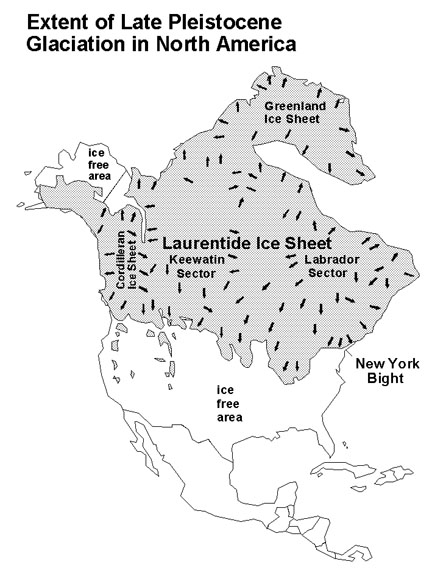
Image to the right shows the extent, in grey, of the continental ice sheet during the Late Pleistocene (the more recent large scal expansion). Note that 4 different ice sheet centers (Cordilleran, Keewatin, Labrador and Greenland) merged to make one large ice sheet. Image source from USGS site. Quaternary Geology of the New York City Region: http://3dparks.wr.usgs.gov/nyc/moraines/quaternary.htm , and map has been modified from Pielou (1991) .
The overall pattern is of major advances and retreats with minor advances and retreats superimposed. This is suggestive of different factors operating at different time scales to influence global climate.
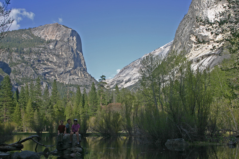
Slightly oblique view of U-shaped valley in Yosemite, carved into the Sierra Nevada Granite.
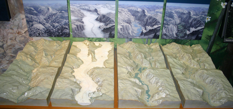

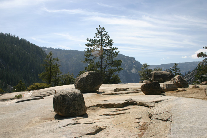
Glacial erratics perched at the lip a hanging valley in the higher portion of Yosemite National Park.
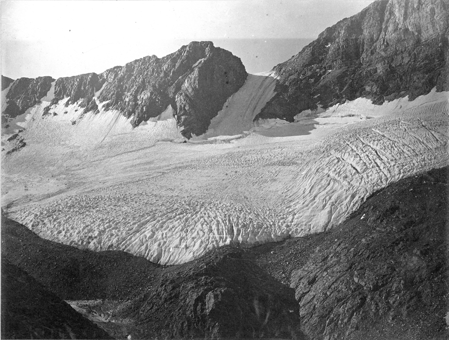
1883 photograph by Isreal Cook Russell of Dana glacier in the high portion of Yosemite area. It is now a small fraction of this size. Image source: https://www.sciencebase.gov/catalog/item/51ddac64e4b0f72b4471ed99 .
Evidence that Pleistocene glaciers reached into Nebraska
The evidence is widespread. In addition to the striae and tillites shown below, we also have the remains of Ice Age animals such as mastodons and mammoths to testify to the different climate in the Ice Age.
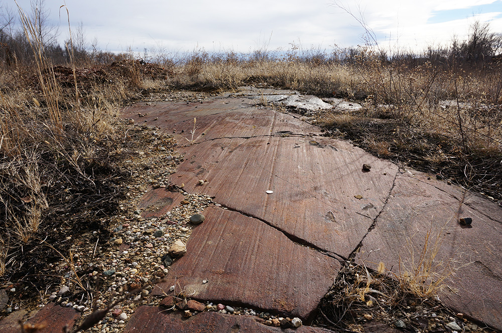
This is an outcrop of the surface of the Dakota Sandstone exposed in central Omaha. The striated and polished surface is from a past glacial ice sheet that moved over this bedrock. The striae are oriented roughly N-S, indicting the direction that glacier was moving.
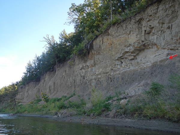
Outcrop along the Elkhorn River downstream of Arlington. The lower dark layer is clay rich, but also has boulders in it, which is the classic signature of a till. This unit is widespread and can be found at several outcrops along the Elkhorn spaced tens of miles apart. The red arrow shows the contact with the overlying sands and gravels. These are outwash deposits, left as the retreating glacier melted and fed vigorous rivers.
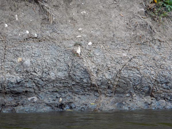
This is a close up of portion of the cliff above. One can see the larger boulders embedded within the fine-grained massive material. The larger boulders in them are distinctive and can be matched with rocks exposed farther north, including Canada. The only way we know of to get such poorly sorted, far traveled (wide range of grain sizes) and widespread deposits is from glacial deposition. This then is a glacial till. These tills continue down into Kansas.
Huronian (2.1 billion years ago).
Vendian and the snowball earth (mentioned before): 650 to 540 Ma.
Gondwana (Permo-Carboniferous), around 275 Ma.
What are some of the potential causes of Ice Ages?
Evidence for past glaciation on Mars!
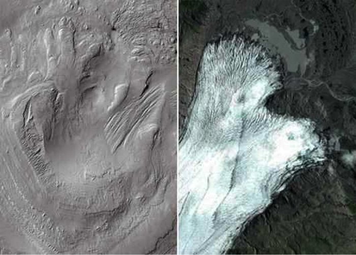
Image to left from Mars, and to right of a glacier on earth. Some scientists interpret the features on Mars as moraines and other features formed from past glaciers. Image source: NASA - http://pics-about-space.com/nasa-mars-equatorial-glaciers?p=1 .
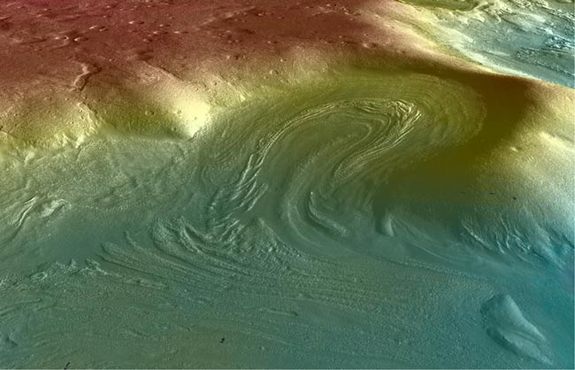
Another image from Mars showing distinct features reminiscent of glacial moraine deposits. Same source as above.
Harmon D. Maher Jr. reserves copyrights to the materials in this site. Material may be used for non-profit educational purposes as long as proper attribution is given. For permission for any other use please contact author. Thank you.
Return to Physical Geology index page.
Return to my home page index.